


Earth Elevation CROSS-SECTIONS ALONG PARALLELS
Notes
How high are the mountains? How deep is the sea?
I've been working with elevation and bathymetry data as part of my quest to make beautiful, tactile, custom wooden globes:
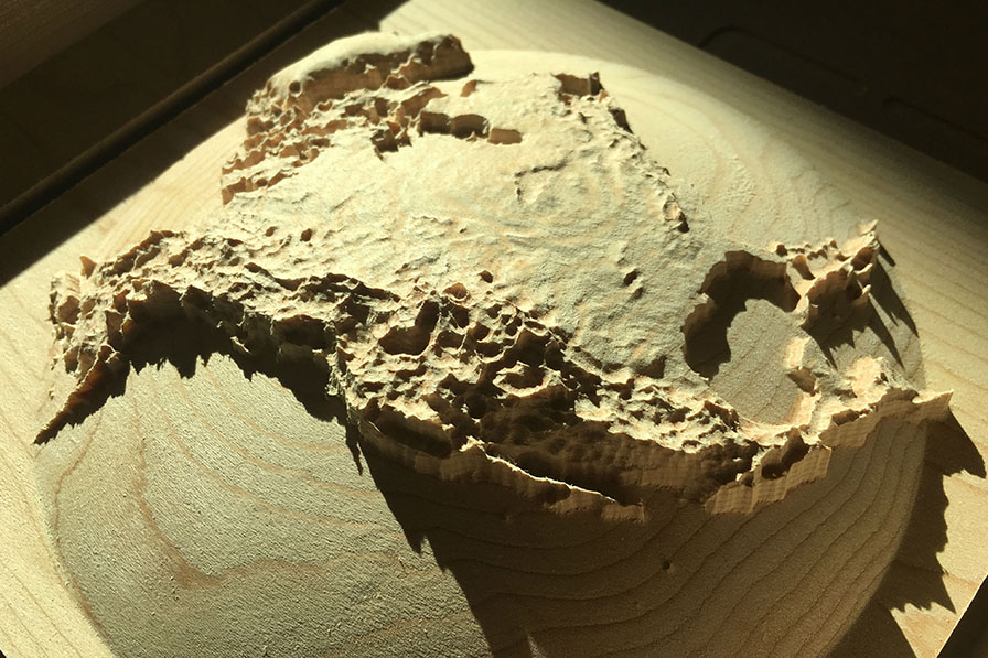
You can pre-order your own fully three-dimensional maps and globes, carved into fine hardwood, at the goodwoodglobes crowdfunding campaign on Indiegogo.
This animation shows cross-sections through the continents and the oceans along circles of latitude from the North Pole through the Equator to the South Pole.
As well as playing this animation from beginning to end, you can use the slider on the right to set the latitude.
I find it fascinating to see the continuity between the elevations of the continents and the depths of the oceans. It's as if the continents are strange, rare protuberances from the ocean floor.
A note on the names of the geographical features: to make the animation work, I've dropped the descriptive elements of all names. So the Arctic Ocean is shortened to ARCTIC, the Bay of Bengal is shortened to Bengal, and both the Mexican Plateau and the Gulf of Mexico are both shortened to Mexico. The names of continents, islands and mountain ranges are in brown and the names of oceans and seas are in blue; continents and oceans are capitalized.
Think I'm exaggerating? Well, yes, it's true, without exaggeration of the elevations of the continents and the depths of the oceans, the Earth looks kinda flat, so I've used a vertical exaggeration of ×1000 for this visualization.
Subscribe now and I’ll let you know whenever I create a new visualization
It’ll only be every couple of months or so, I won’t let anyone else have your email address, and you can unsubscribe at any time
Thanks for subscribing!
Check your inbox for an email to confirm your subscription
Oh no, something went wrong, and I was unable to subscribe you!
Please refresh your browser and try again
Sources
Combined elevation and bathymetry data from National Oceanic and Atmospheric Administration – National Centres for Environmental Information – ETOPO1 Global Relief Model Amante, C. and B.W. Eakins, 2009. ETOPO1 1 Arc-Minute Global Relief Model: Procedures, Data Sources and Analysis. NOAA Technical Memorandum NESDIS NGDC-24. National Geophysical Data Center, NOAA. doi:10.7289/V5C8276M. Accessed 16 February 2019.
Date
First published 21 February 2019

Comments
Click here to leave a comment
Thanks for your comment!
I’ll check it and put it live as soon as I can
Oh no, something went wrong, and I was unable to post your comment!
Please refresh your browser and try again